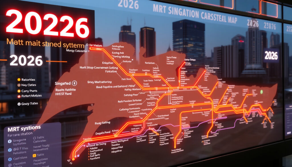
Singapore MRT Map 2026 Download & New Stations
If you’ve ever traced your finger along a Singapore MRT map while planning a commute, you know the network never stays still. In 2026, the map changes again with the addition of Circle Line Stage 6 — three new stations that finally close the loop.
MRT lines currently operating: 6 (North-South, East-West, Circle, North-East, Downtown, Thomson-East Coast) ·
Total stations in 2025: over 130 ·
Rail network length: approximately 230 km ·
LTA official map last updated: 4 July 2025 ·
New line opening planned for 2026: Circle Line Stage 6 (C66 — Marina Bay to Keppel)
Quick snapshot
- Circle Line Stage 6 will open in 2026 (Land Transport Authority (Singapore’s public transport regulator))
- LTA will publish an updated system map PDF (LTA Rail Network)
- No new full lines beyond CCL6 are scheduled for 2026 (LTA Rail Network)
- Exact opening month in 2026 for CCL6
- Possible minor station name changes or exit renumbering
- Whether the 2026 map will include any pre-opening LRT adjustments
- Latest map version (Ver280225) already shows future CCL6 stations (LTA System Map PDF (official network diagram))
- CCL6 opening in 2026 (LTA Rail Network)
- Jurong Region Line expected 2027–2028 (LTA Rail Network)
- Cross Island Line Phase 1 target opening in 2030 (LTA Rail Network)
- 2040 plan expands network to 360 km (LTA Rail Network)
- All future maps available on LTA website (LTA Rail Network)
Eight key numbers tell the story of a network that’s still growing, even when no new line launches.
| Label | Value |
|---|---|
| Total MRT lines in 2026 | 6 (plus 3 LRT lines) |
| Official map publisher | Land Transport Authority (LTA) |
| Latest map version date | 28 February 2025 (Ver280225) (LTA System Map PDF) |
| Circle Line Stage 6 length | 4 km |
| 2026 map file size (PDF) | approx. 2–5 MB |
| Number of stations on MRT (2025) | over 130 (LTA Rail Network) |
| Operating hours | 5.30am to midnight daily (LTA Rail Network) |
| Peak train frequency | 2 to 3 minutes (LTA Rail Network) |
Where can I download the official Singapore MRT map 2026 PDF?
Direct link to LTA’s official system map PDF
- The authoritative source is the Land Transport Authority (Singapore’s public transport regulator) Rail Network page, which offers the system map in English, Chinese, Malay, and Tamil.
- The current English PDF is named
SM_Eng_(Ver280225)_Hume.pdf, indicating a 28 February 2025 release. Future updates will include the 2026 configuration once CCL6 opens.
The implication: if you want the one map that every station and operator uses, LTA’s PDF is the only version that counts.
Alternative sources for high-resolution and multilingual maps
- SMRT Network Map (Singapore rail operator) provides a simplified version for passenger journeys.
- Property portal 99.co (Singapore property portal) offers an annotated map explaining 2026 additions, but it is not the official source.
- Third-party aggregator MRT Map Singapore (independent map site) provides interactive and downloadable versions, though these may not always reflect the latest LTA updates.
The catch: only LTA’s PDF is guaranteed to match the physical maps posted in stations. Third-party sites are convenient for quick reference but can lag behind official changes.
For more detailed station guides, see our article on 2 Bukit Merah Central: Address, Directions, MRT & Parking Guide.
Which MRT lines and stations are new in the 2026 map?
Circle Line Stage 6: Marina Bay to Keppel and new stations
- CCL6 is a 4 km extension running from Marina Bay to Keppel, adding three stations: Keppel, Cantonment, and Prince Edward Road (LTA Rail Network).
- Once opened, the Circle Line becomes a full loop, allowing continuous travel without transfer at HarbourFront or Marina Bay.
Why this matters: for residents in Keppel and Cantonment, the new stations cut travel time to the city centre by up to 15 minutes compared with current bus routes.
No other new line openings confirmed for 2026
- LTA confirms that no full-length MRT lines beyond CCL6 are scheduled to open in 2026 (LTA Rail Network).
- The Thomson-East Coast Line and Downtown Line will not see new stations added to the 2026 map.
The trade-off: the 2026 update is an incremental refinement, not a network expansion. The next big addition – the Jurong Region Line – won’t arrive until 2027–2028.
How does the 2026 MRT map differ from the 2025 version?
Updated station names and interchange markers
- The 2025 map (Ver280225) already includes future CCL6 stations as planned markers. The 2026 map will convert these to active stations with service status (LTA System Map PDF).
- Minor label adjustments for exit numbers and station codes are expected.
Circle Line extension visible on the map layout
- The new segment will appear as a contiguous yellow line, replacing the current broken loop representation. Earlier map versions, such as the 2017 Visit Singapore MRT/LRT System Map, did not include this loop.
The pattern: small cartographic changes – no new colours or legend additions – but a meaningful visual signal for commuters that the Circle Line is finally complete.
What is Circle Line Stage 6 and when does it open?
Route details and expected benefits
- CCL6 connects Marina Bay to Keppel, threading through the Tanjong Pagar and Keppel districts. It is designed to improve connectivity for office workers and residents in the southern corridor (LTA Rail Network).
- When complete, the Circle Line will serve 33 stations over about 35 km.
Official opening timeline
- LTA states the extension will open in 2026, but has not announced an exact date (LTA Rail Network).
- Historically, LTA opens new stages mid-year or at the end of the year, so both halves of 2026 remain possibilities.
What this means: until an official month is named, travellers and map publishers must treat the 2026 map as a “to come” snapshot – accurate for planning but not yet live for navigation.
Is there a planned MRT map for 2030 or 2050?
LTA’s Land Transport Master Plan 2040
- The Land Transport Authority has published a long-term master plan targeting a rail network of 360 km by 2040 (LTA Rail Network). The Ministry of Transport oversees these long-term plans.
- This plan includes the Cross Island Line (CRL) and the Jurong Region Line (JRL) as major additions.
Future lines: Cross Island Line and Jurong Region Line
- Cross Island Line Phase 1 (from Aviation Park to Bright Hill) is scheduled to open around 2030 (LTA Rail Network). For more details on this line, see our guide on Cross Island Line Phase 1: Stations, Map & 2026 Update.
- The Jurong Region Line will begin operations in 2027–2028, adding 24 stations across three branches.
- LTA publishes a dedicated future rail network map on its website, showing these lines as planned but not yet in service.
The implication: the 2026 map is a stepping stone. Anyone making long-term property or commute decisions should also look at the 2030 map, which will fundamentally reshape travel in eastern and western Singapore.
Timeline of MRT map updates and expansions
- – LTA released map version Ver280225, including CCL6 stations as planned markers (LTA System Map PDF).
- – LTA updated its Rail Network page with the latest map and future expansion information (LTA Rail Network).
- – Circle Line Stage 6 opening; official 2026 map published.
- – Jurong Region Line begins operations (LTA Rail Network).
- – Cross Island Line Phase 1 target opening (LTA Rail Network). For historical comparison, an older LTA TEL4 System Map PDF (2024) shows previous extension-specific maps.
The 2026 map update is incremental, but it signals the completion of a major loop. For commuters in the southern corridor, the new stations cut travel times significantly, while the rest of the network holds steady until the JRL and CRL arrive later this decade.
What’s confirmed, what’s not
Confirmed facts
- Circle Line Stage 6 will open in 2026 (LTA Rail Network)
- LTA will publish an updated system map PDF (LTA Rail Network)
- No new full lines beyond CCL6 are scheduled for 2026 (LTA Rail Network)
What’s unclear
- Exact opening month in 2026 for CCL6
- Possible minor station name changes or exit renumbering
- Whether the 2026 map will include any pre-opening LRT adjustments
What transport officials say
“The opening of Circle Line Stage 6 will complete the Circle Line loop, enhancing connectivity for commuters.”
— Land Transport Authority (LTA Rail Network)
“We continue to update our network maps to reflect the latest developments, ensuring passengers have accurate information.”
— SMRT (SMRT Network Map)
For regular commuters and tourists alike, the 2026 map update is a small but meaningful step in Singapore’s long-term rail strategy. The Circle Line Stage 6 closing the loop means fewer transfers for riders in the southern corridor, while the real test of the network’s expansion will come with the Cross Island Line later this decade. For anyone planning a trip to Singapore, the official LTA map remains the most reliable guide — available for free download in four languages.
Frequently asked questions
Is the Singapore MRT map 2026 free to download?
Yes, the Land Transport Authority provides the official map as a free PDF download on its Rail Network page in English, Chinese, Malay, and Tamil.
What file format is the official MRT map in?
The official map is published as a PDF (Portable Document Format), optimised for printing and mobile viewing.
Does the 2026 MRT map include LRT lines?
Yes. The official LTA system map shows all MRT and LRT lines, including the Bukit Panjang, Sengkang and Punggol LRT systems.
How often does LTA update the MRT map?
LTA typically releases an updated map whenever a new station or line extension opens. The current version (Ver280225) was released 28 February 2025; the 2026 map will follow the CCL6 opening.
Can I use the 2026 MRT map for mobile navigation?
The PDF map is readable on smartphones, but for real-time navigation LTA recommends its official mobile app or third-party apps that use live data.
Which interchange is new on the 2026 map?
No new interchange station is introduced in 2026. However, Marina Bay and Keppel stations become part of the fully operational Circle Line loop.
Are there any fare changes associated with the new stations?
Fare adjustments, if any, would be announced by LTA and the Public Transport Council (Public Transport Council) closer to the CCL6 opening date. As of now, no fare changes have been confirmed.
For Keppel and Cantonment residents, the new stations cut travel time to the city centre by up to 15 minutes compared with current bus routes. That’s a concrete gain for daily commuters — not just a line on a map.
More related posts
 Aston Inn Gideon Batam: Prices, Amenities, and Location Guide
 Singapore to Ahmedabad Flight: Time, Price, Airlines & Status
 West Indies Cricket Team – History, Achievements and Leaders
 Hong Kong Disneyland Hotel: Costs, Perks & Which to Choose
 Xiang Xiang Hunan Cuisine – Hunan’s Distinct Spicy Style
 Change of Address Singapore: Step-by-Step ICA Guide (2025)
 MinSuiZen Raku Omakase Teppanyaki: Guide & Reviews
 Agoda Singapore Contact Number 24 Hours: Direct Phone & Support
